New Zealand currently has 10 Great Walks, with Hump Ridge soon to be number 11. One of the Great Walks is not a walk at all: the Whanganui Journey is an 87 or 145km canoe trip from either Whakahoro or Taumarunui to Pipiriki on the Whanganui River, over 3 or 5 days.
- Emerald Hours review: Taumaranui to Pipiriki in early 1900s
- Full trip gallery; [before], [day 1], [day 2], [day 3], [day 4], [day 5]
Tip: on my site, you can often click on pictures and get the link to the full version.
Having paddled the 5-day version of this Journey in April 2024, I now can update that review with our actual experiences on and around the river.
Getting to Taumarunui (by transit)
No cars, no planes. Buses and trains (and vans) from our place in Wellington to this adventure. I always find it to be a waste to rent a car for an adventure and leave it parked all the time (even more than how cars usually spend vast majority of their time parked).
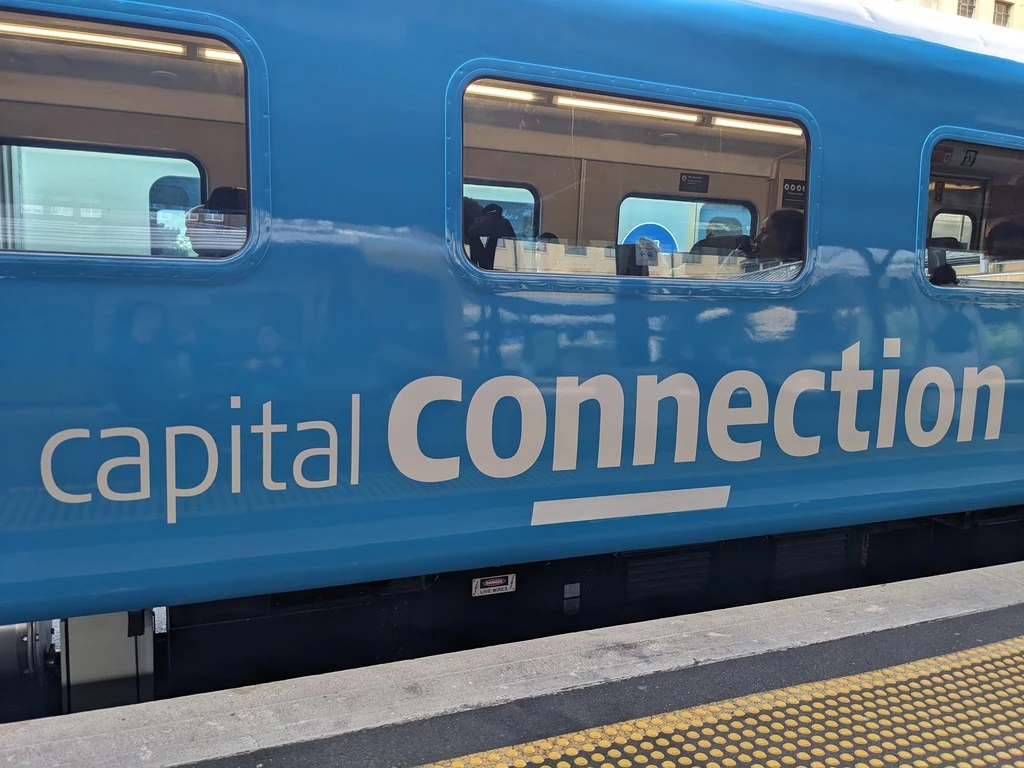
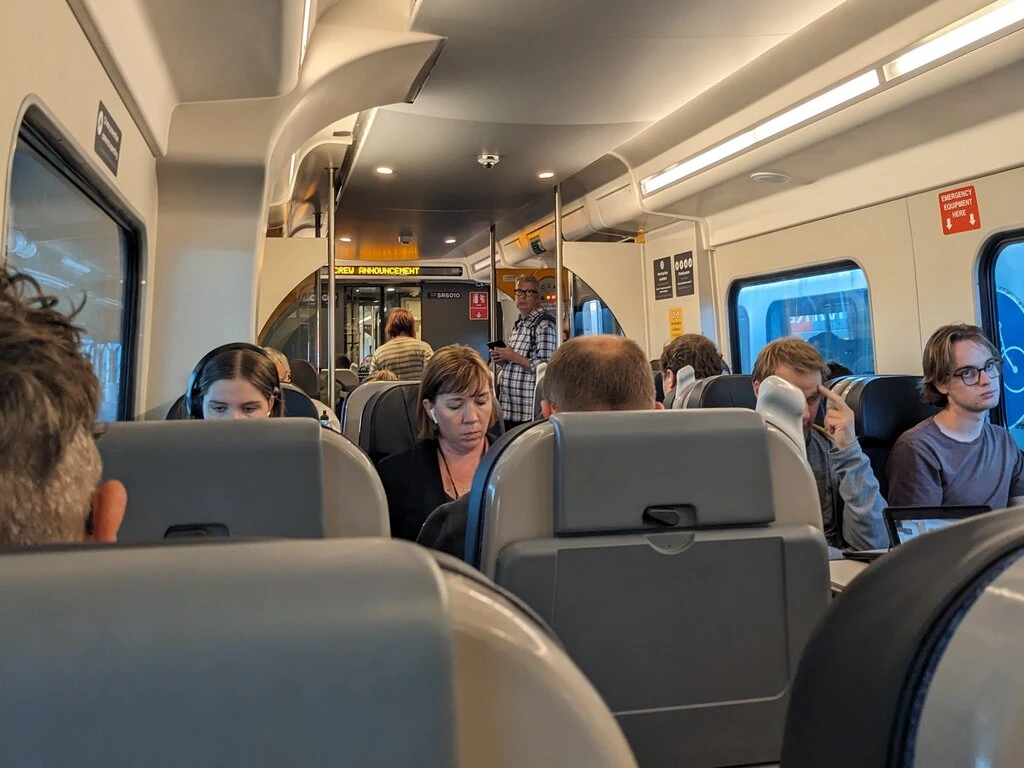
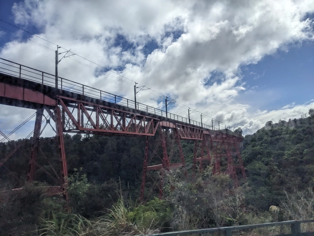
The Northern Explorer train runs from Wellington to Taumarunui. We wanted to be in Taumarunui for Friday, March 29, which would have actually worked with the Friday/Sunday/Wednesday northbound schedule. But, we instead took the Capital Connection to Palmerston North and then the InterCity bus to Taumarunui. I guess I just wanted to take the Capital Connection. I did not compare prices, but all of our tickets were not cheap. More than GO Transit for sure.
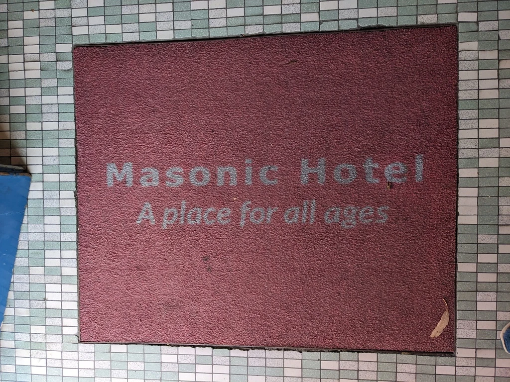
The Capital Connection was chocka (full) on the day before the Easter weekend. On the train I wrote feedback to the NZ Government about the terrible draft Government Policy Statement on transport (“moar cars”). Getting off at the end of the line in Palmerston North, I saw a handful of bike commuters who had taken the train. We walked 2km to the the Masonic Hotel (“A place for all ages”), which seemed like it might be a bit dated. The room was not dated at all and had a toaster, which we used to toast all of our bagels.
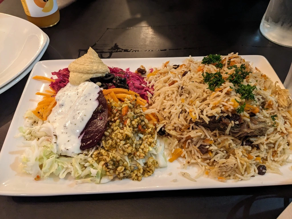
The Afghan Darbar Restaurant was a great option. They have doner and kebap, but also Afghan dumplings and Kabuli Pulao. I had the pulao (not so common around here) which was tasty, with tender meat.
The next morning I found Alexandre Patisserie, whose Google directions aren’t accurate. Croissant was good but not as good as the best NZ croissant I’ve had (Le Moulin, Christchurch). Took sandwiches away for lunch as well. They didn’t actually speak French, even if they greet you with “Bonjour”.
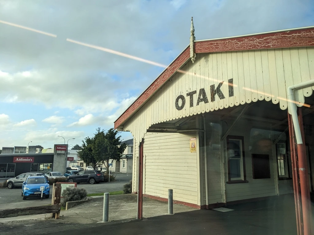
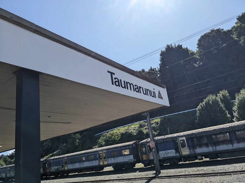
The InterCity then took us to the Taumarunui train station by 2. It being Good Friday, almost everything was closed. We grabbed second lunch and (takeaway) dinner at Jasmine’s Cafe & Thai Restaurant. Like many places in NZ, it was a bit too sweet, but the fried rice was OK. Could have used some hot sauce, but we didn’t have any.
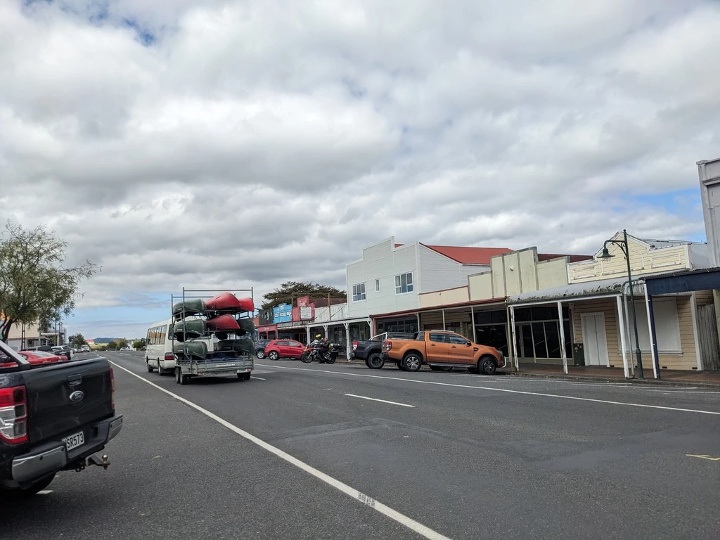
Taumarunui Canoe Hire
In Emerald Hours, the author didn’t like the lodging options in Taumarunui. We stayed outside town and didn’t explore those options at all.
Specifically, Taumarunui Canoe Hire will pick you up in town (in a van) at 4 and drive you the 3km to their base camp. The distance is definitely walkable but we decided to stay in Taumarunui for 2 hours instead of walking for 45 minutes.
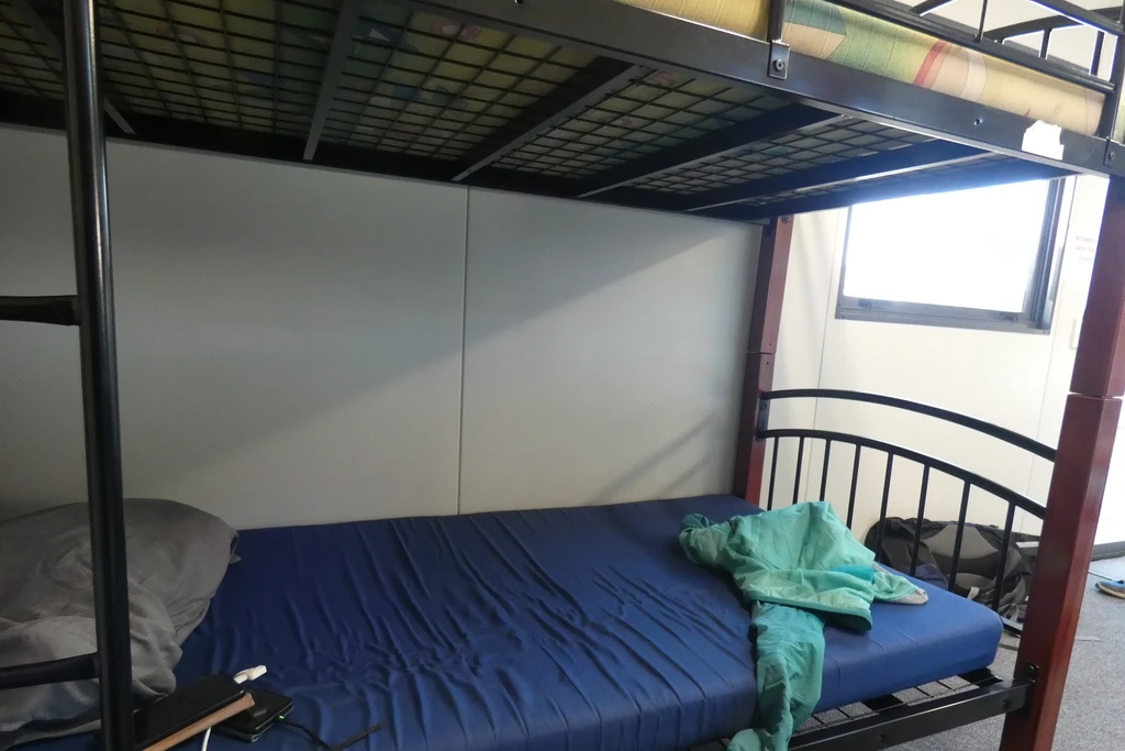
At the TCH base camp, they have some new portable bunkrooms, whose mattresses were more comfortable than our inflatable ones, and which also meant that we didn’t have to put away our tents the next morning.
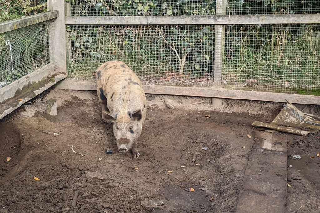
Their base camp also has a cat, a pig, and half a dozen minature poodles with another 5 poodle puppies in a playpen.
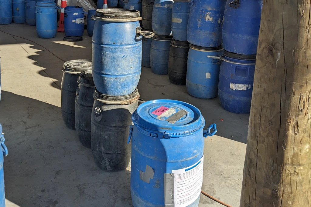
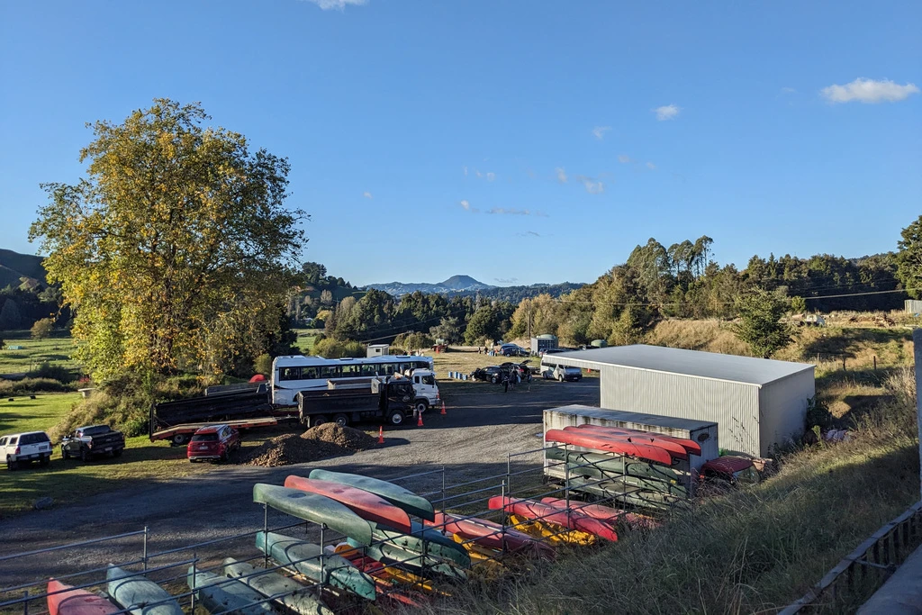
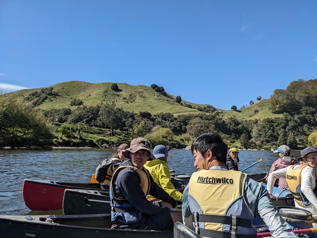
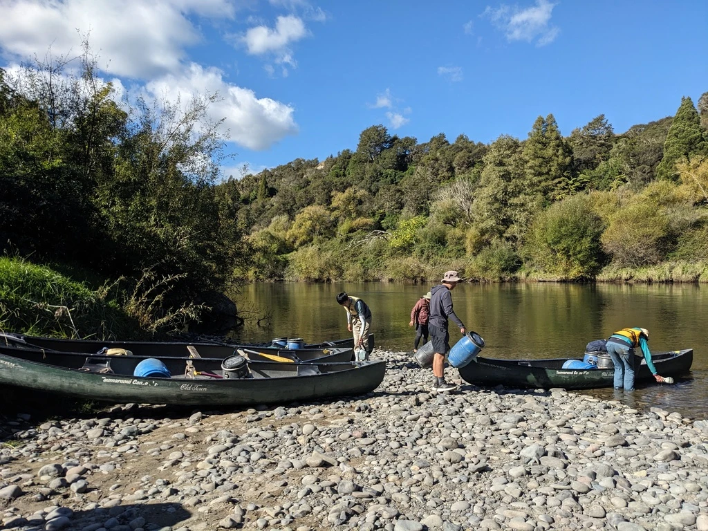
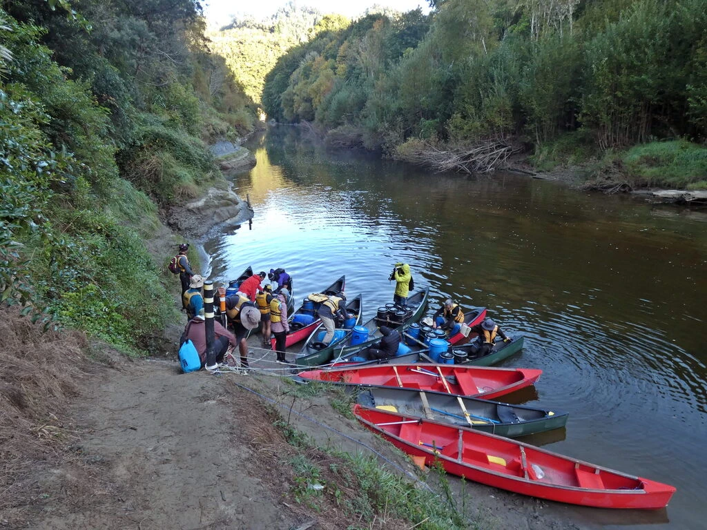
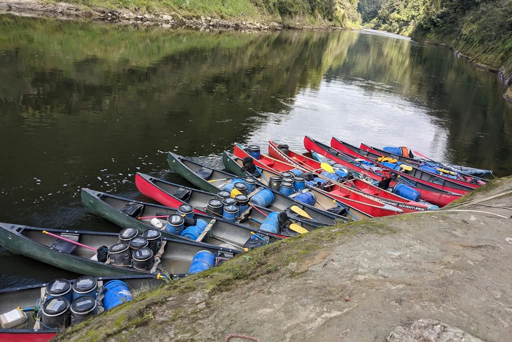
Our departure briefing was at 9:30am the next morning, said the info on our (probably waterproof) barrels. Well, the small 4 barrels were supposedly waterproof; the large one (for tents) not. I noticed Robert’s group of 16 with tons of barrels, also leaving with us on a 5-day trip. We packed our barrels in the evening so that we wouldn’t have to do anything in the morning. (Breakfast ended up being some bars; no cleaning needed.)
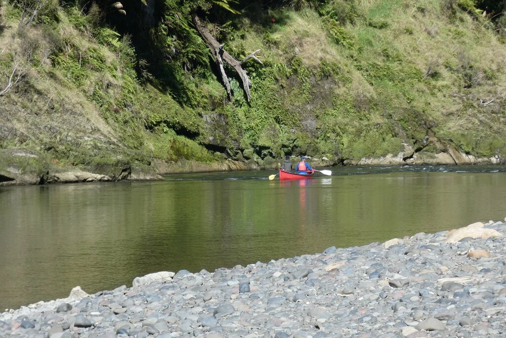
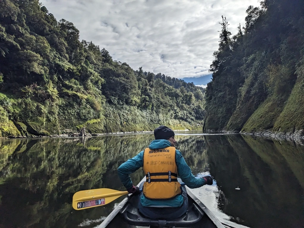
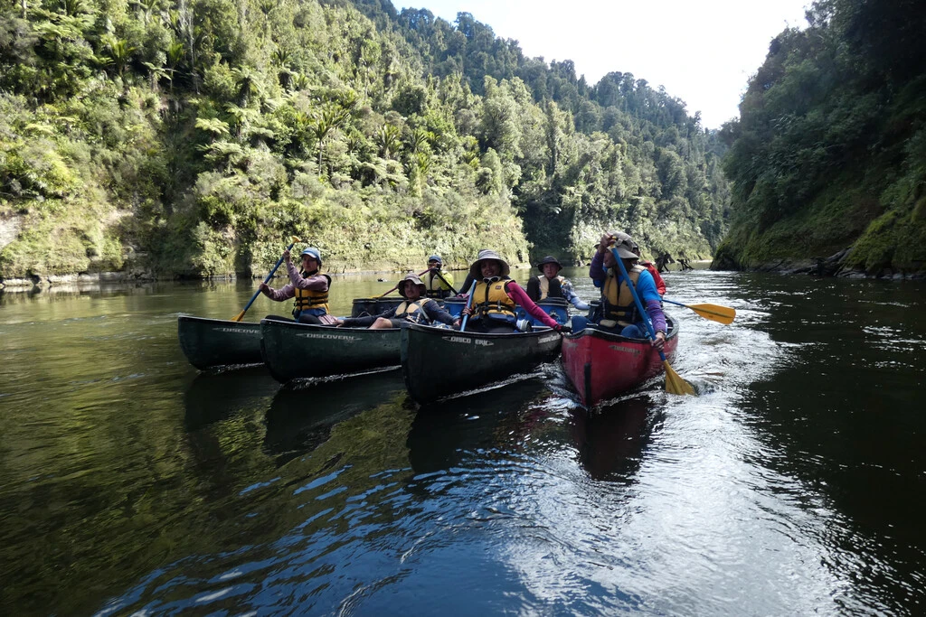
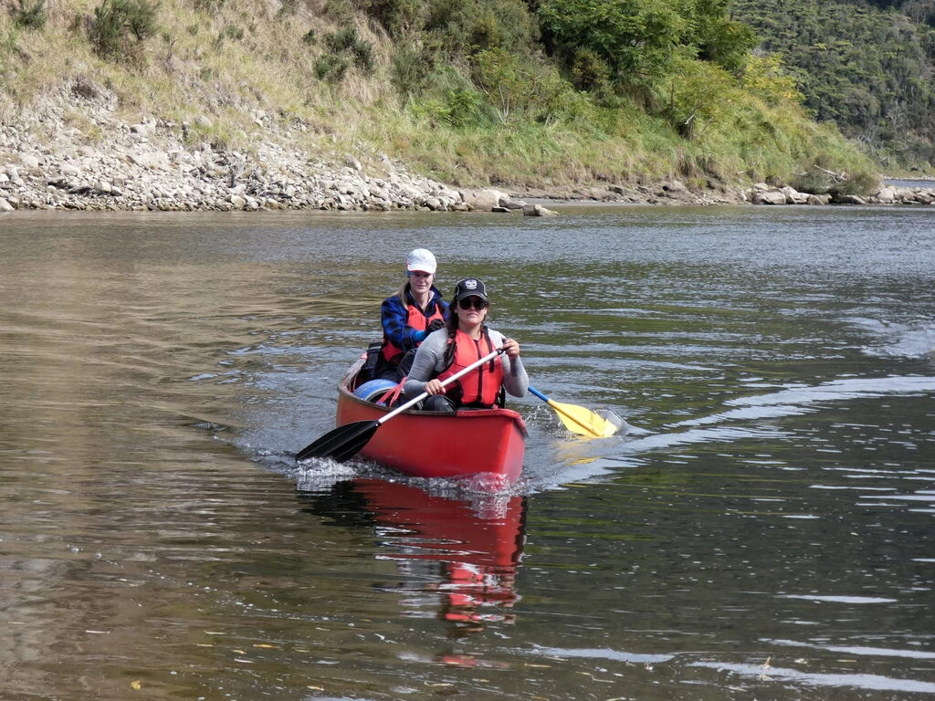
Day 1: On the river; Taumarunui to Ohinepane to Poukaria, 35km
Turns out that “Robert” was Rob O’Callahan, who I’d last seen at SPLASH 2022 in Auckland, and had known from way back. He runs these trips with a big crowd and, in this case, had coincidentally planned the Whanganui River Journey at the same time as us. We’d be staying at the same places except on the first night, where he was at Ohinepane and we were 2 hours down the river at Poukaria. We had, however, managed to get huts for the nights after the first night; easier for 2 than for 16! [Rob’s writeup]
Since we were both doing 5-day trips, they had us at the same 9:30 briefing, where they told us about some of the highlights along the river, and some tips about whether we should go left or right. We just had to remember them for 5 days.
Two hours later, we had been briefed, loaded the canoes, and had some practice for newbies. The guy doing the briefing was concerned about one of the canoe teams, gave them a kayak paddle in case it would help (it didn’t), and correctly predicted that they wouldn’t make it upright through the first rapids, which were just 30 minutes in.
Except for the 50/50 rapids right at the end on day 5, the first day has the most challenging rapids throughout the trip. MP and I managed to get through them all without swimming. There were some spills in Rob’s group.

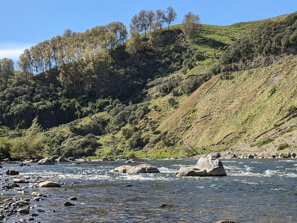
Also, we observed a group (different canoe rental company) who had wrapped one of their canoes around a rock. I didn’t even think those rapids were that big. But MP was busy rubbernecking and I was like “stop rubbernecking! paddle so that we also don’t wrap around a rock!” Their canoe didn’t look to be in very good shape. Fortunately, they did it close to a road, said that they were OK, and had called for help.
We saw that group back on the water on day 3; they seemed to make it to the end from there.
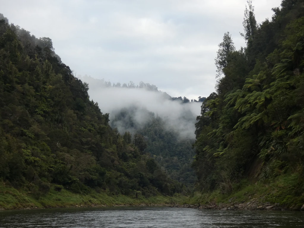
Birds and scenery
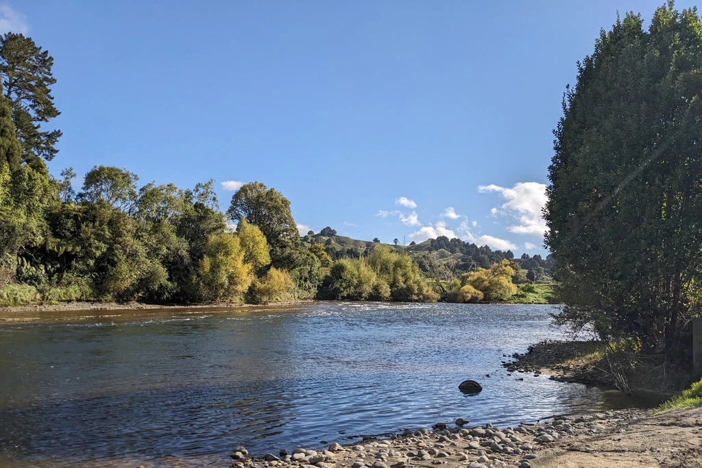
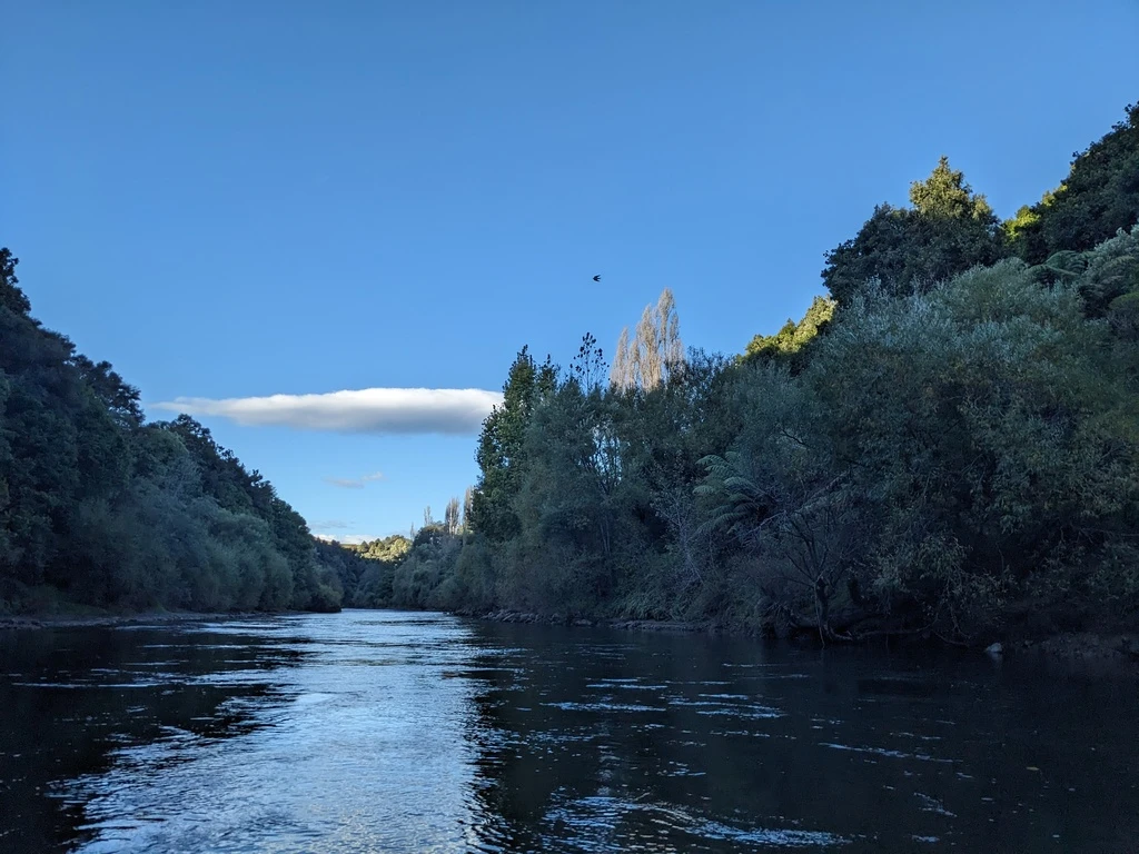
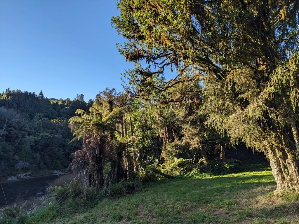
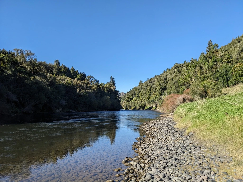
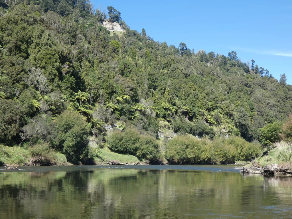
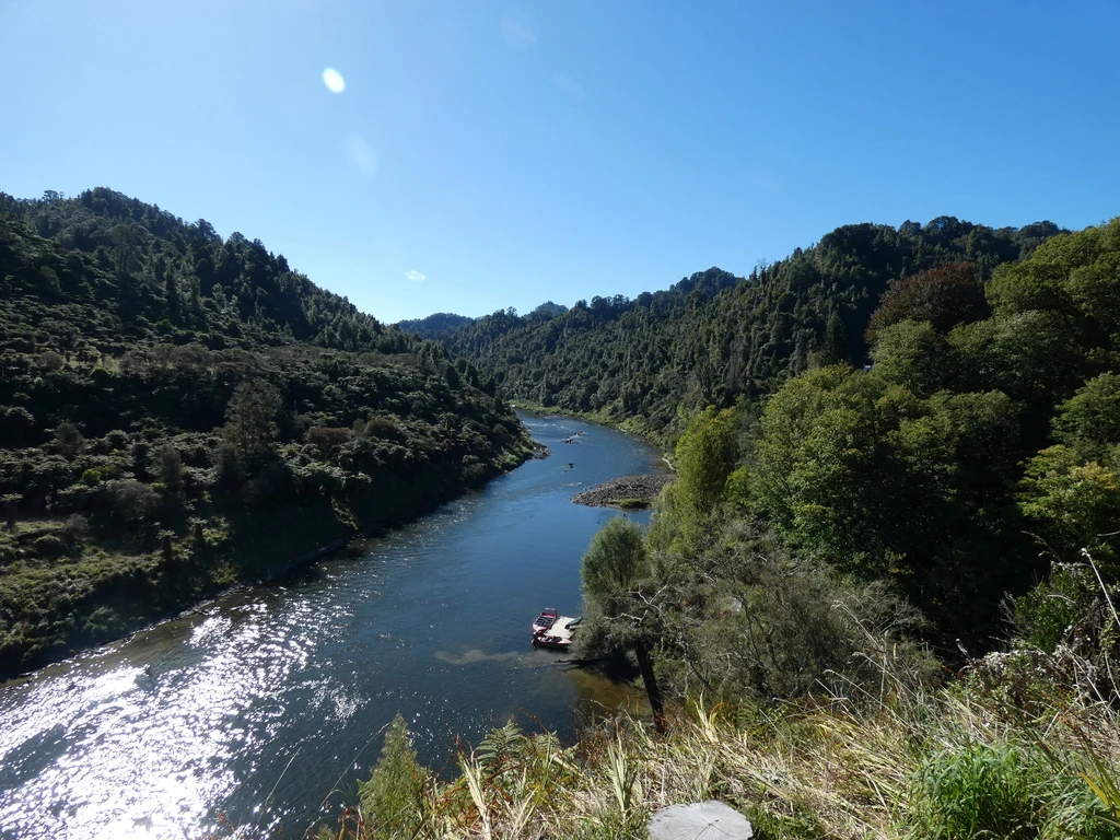
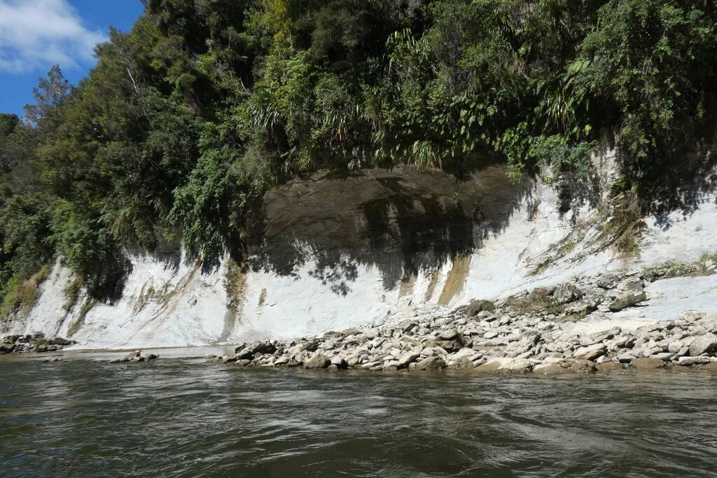
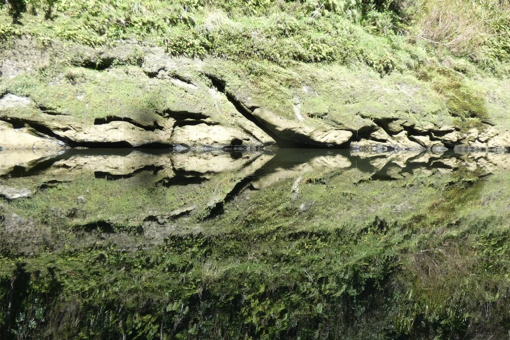
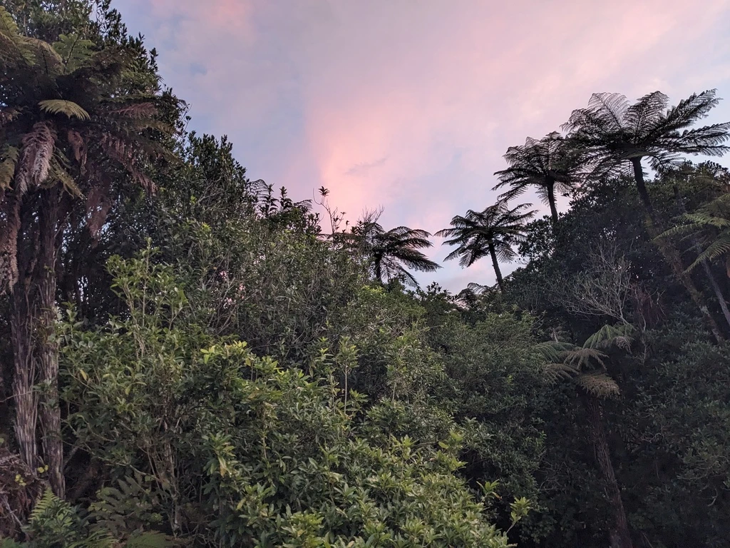
MP had been unconvinced about the scenery on this trip. I think many of the pictures on the Internet don’t do it justice. Maybe some of mine are nice. Anyway, around the Whanganui, you have ferns, as usual in New Zealand, and green. Some other parts of New Zealand are a bit brown now, but not near the river.
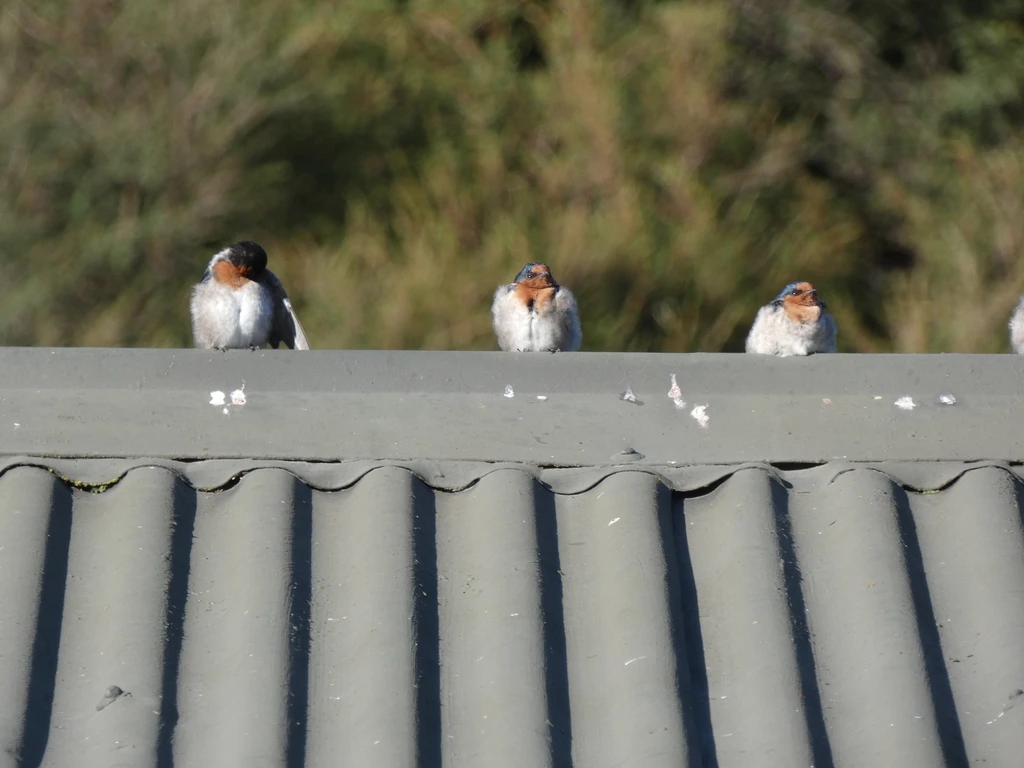
There were also heaps of welcome swallows. More than I’d seen anywhere else. Sometimes dozens of them flying across the river and hunting for bugs. (There were some sandflies, but not that many that were biting). Occasionally we would also see mallards and gray ducks.
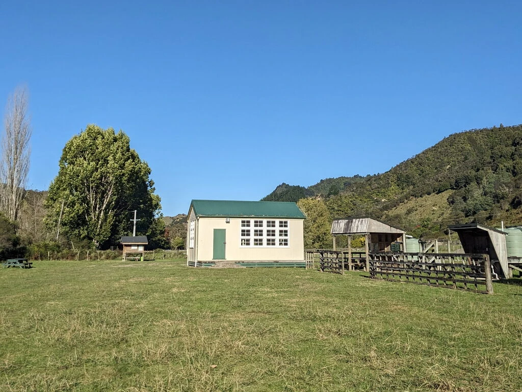
Ohinepane
Ohinepane is the recommended first overnight stop, 22km from Taumarunui. I’d initially booked it, but then changed to Poukaria, so that we would have a shorter day 2. Rob’s group stayed here.
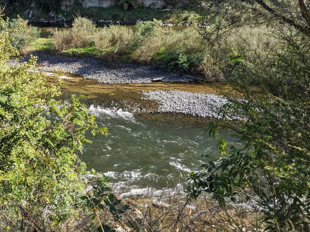
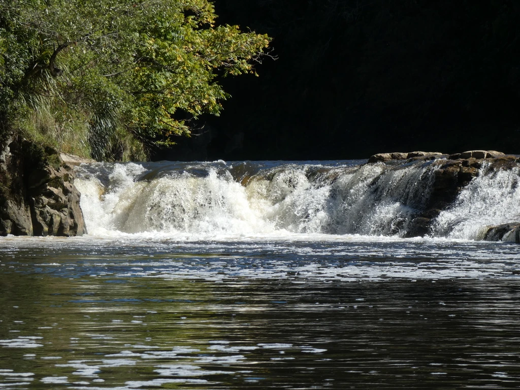
There had been some information in the briefing about staying right; there were allegedly some falls to the left. I tried to scout it out but didn’t see the falls. Anyway, there was a bit more action to the right, but nothing too big.
Onwards to Poukaria
We still had another 7km to go. Although the water wasn’t very white, there was wind making our lives harder, and it started to get cold. Probably this was the toughest 2 hours on the trip.
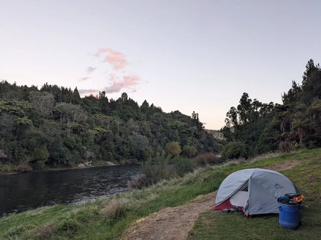
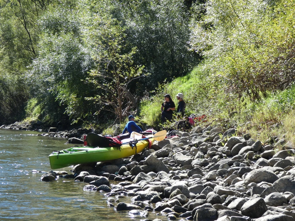
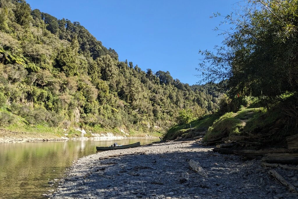
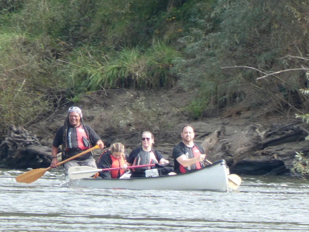
Eventually we got to Poukaria, where there was a group of 5: Claire, Brooke, Carolyn (originally from Canada), Chris, and Josh. We’d also be paddling with them over the next few days.
Poukaria is somewhat slopey and rated for 20 campers. Even with 7 campers it wasn’t that roomy.
Day 2: Poukaria to Whakahoro, 24km
The extra 7km on day 1 meant a shorter day 2; indeed, we spent just over 5 hours on the river, with 4 hours moving time. Less rapids, less wind. We left around 10 and got to Whakahoro by 2:30 or 3, being the first ones there. There were fewer swallows, but some shags (cormorants).
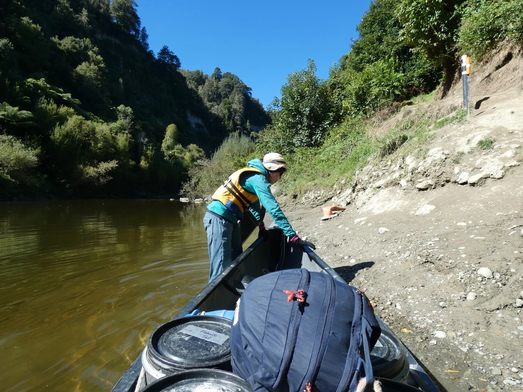
The thing that was least clear was where we should dock. There is a dock on the Whanagui itself, but there is no space to dock there; it’s occupied by a jetboat. Then, there is a sign for the Retaruke River, and an indication that the access to the campsite is 400m up that river. We paddled up the Retaruke and found one potential place to dock. The map indicated another place, further along and under the bridge, but the water was shallow. So we eventually decided to dock at the first place.
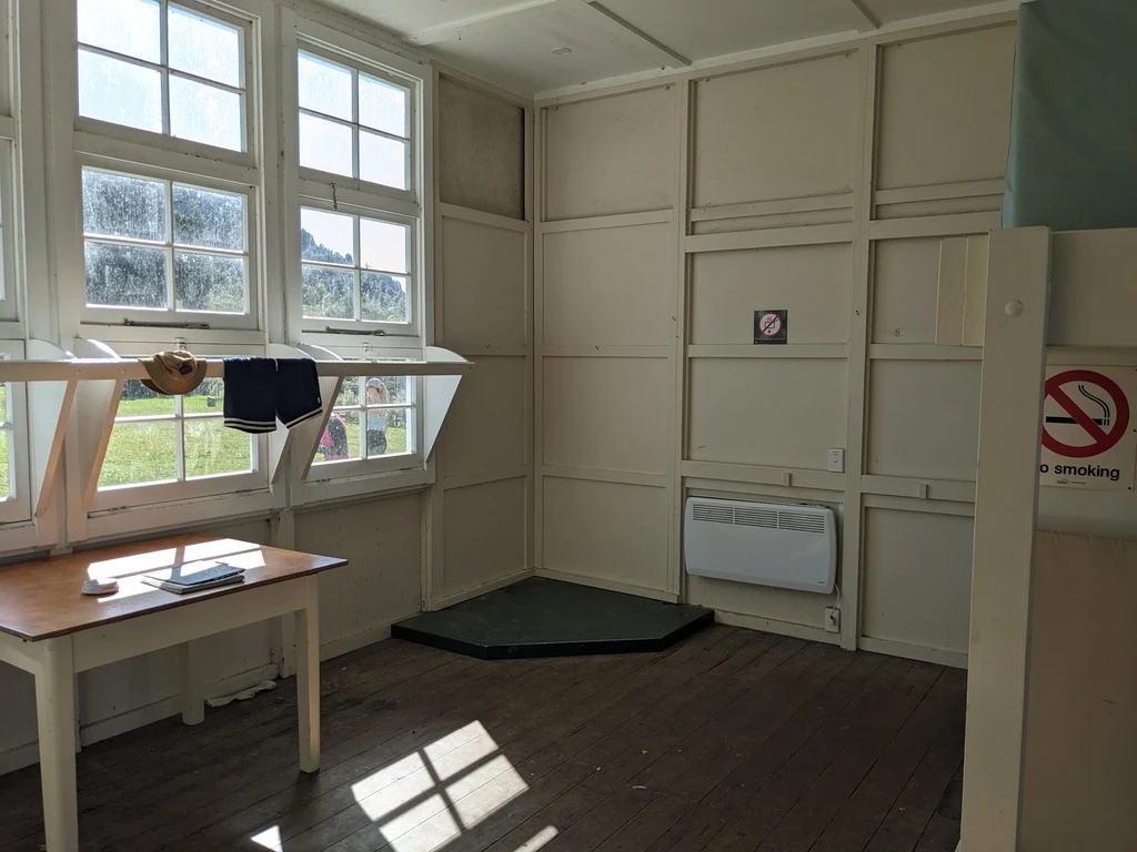
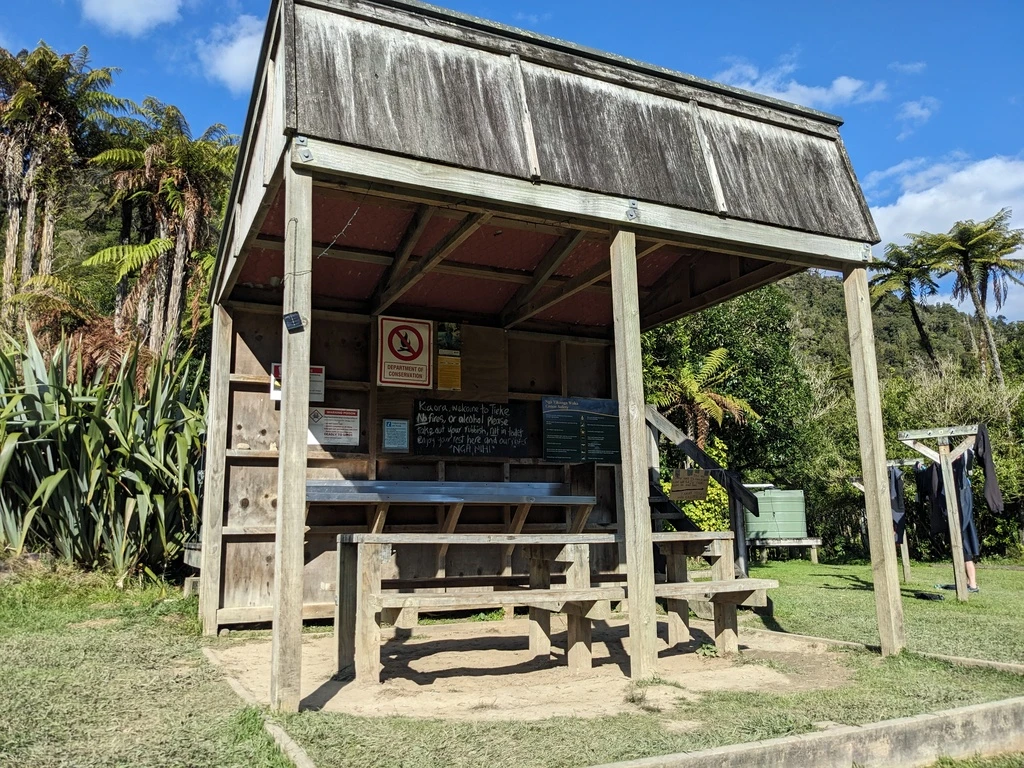
It turns out that there is also a 400m walk with 20m elevation gain from the tie-up to the campsite/bunkroom. Which isn’t that far, but there are barrels to bring up. The hill features prominently in the Intentions Book.
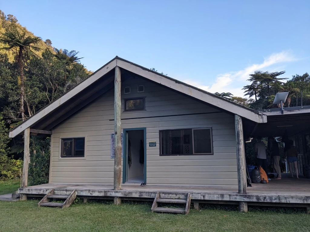
Turns out MP and I were the only ones staying inside the hut (old schoolhouse). The group of 5 and Rob’s group all showed up a bit after us and camped outside. The hut had power and a heater. The heater doesn’t work but the power does.
Although there wasn’t anyone else staying at the campground, various hunters/mountain bikers (not disjoint groups) showed up at various times and left on the mountain biking trails.
Day 3: People show up; Whakahoro to John Coull, 35km
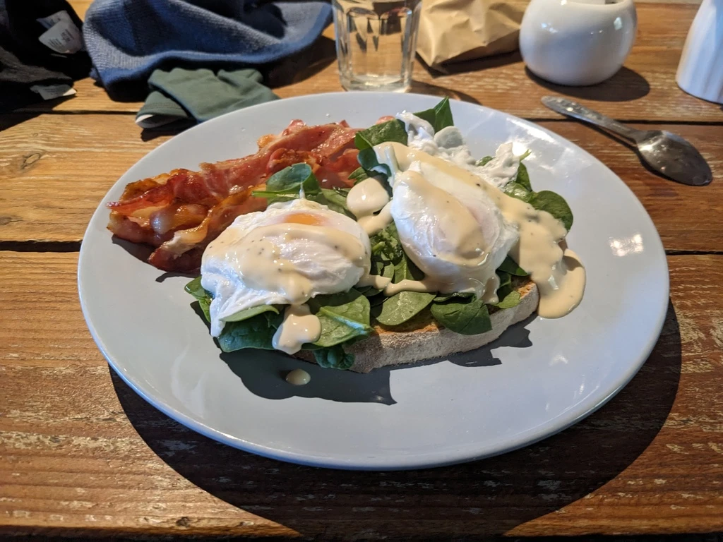
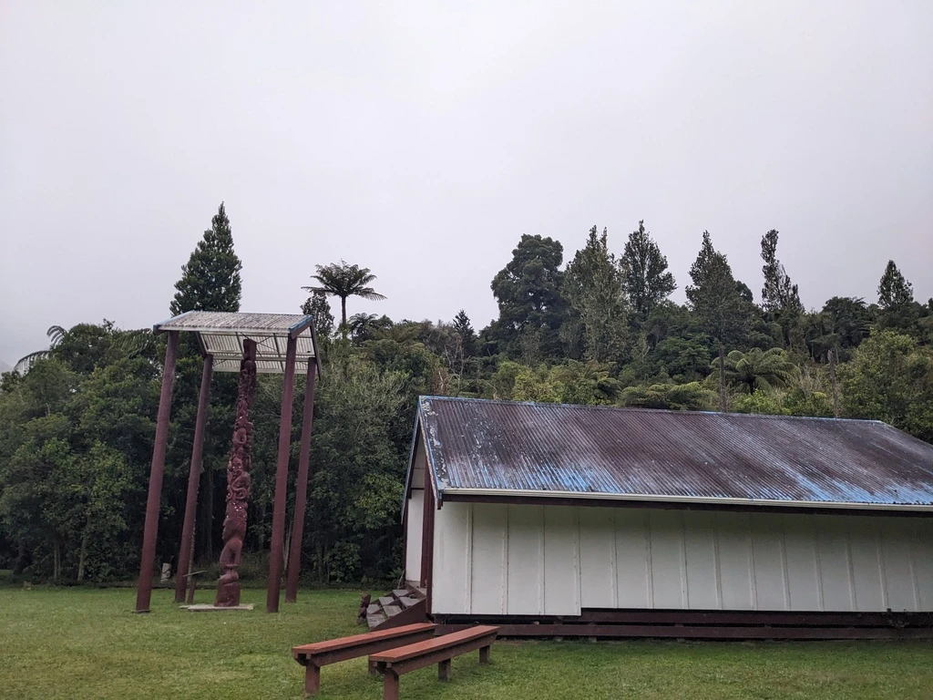
Whakahoro also features the Blue Duck Station, which serves breakfast and lunch. Also accommodation, though I don’t know how that works. I had eggs benedict. Happy to help out local businesses, and a nice change from the ramen that we had for 3 of the 5 days of our trip. The whio (blue ducks) certainly aren’t on the Whanganui, but the guestbook at Blue Duck Station records sightings of blue ducks nearby.
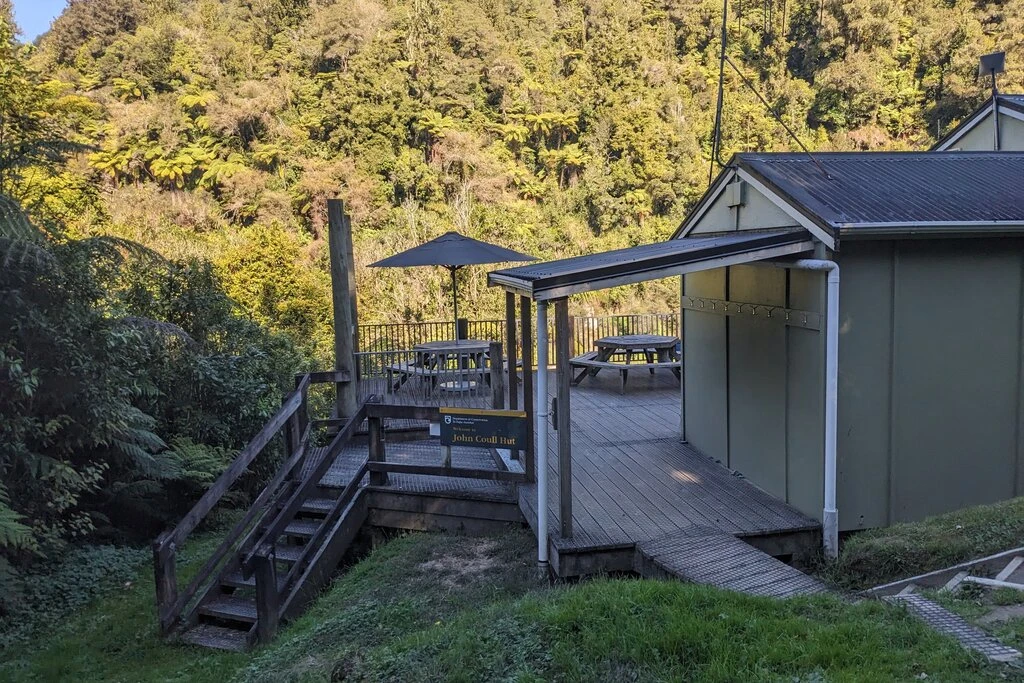
Many of the shorter trips start on this day, and John Coull Hut ended up being at capacity. In particular there was a large Asian group. I talked a bit to the warden, who was a fulltime DOC employee (maintenance) but volunteers to staff the hut when there is a need. He had done the Te Aroroa in 2020 just before COVID.
Again there was no wind and great conditions (mostly sunny). We almost capsized twice when we weren’t paying attention, but it’s not because the rapids were tricky. There was just no reason. I managed to keep our balance though.
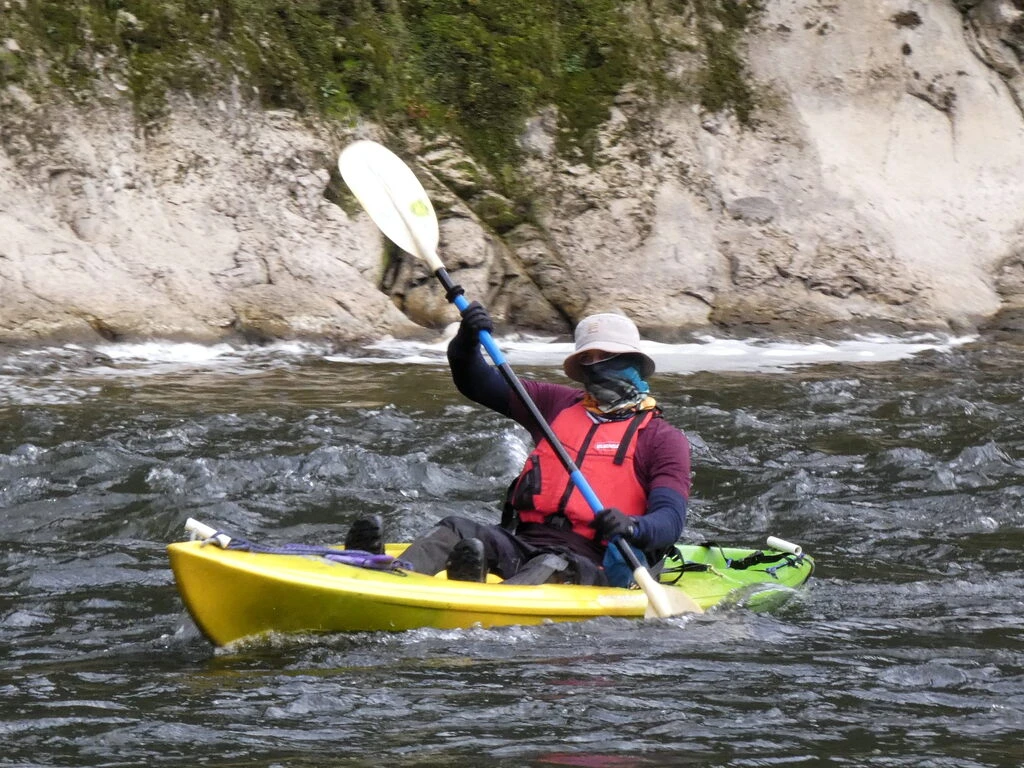
We were passed twice by river guide Stacey’s waka. He also helped rescue one of the other canoes when they tipped over. They can move faster than us, with 4 paddlers, though we still usually averaged a faster speed than them (fewer breaks). A pair of German women also showed up on the river; I thought they were Claire and Brooke, but nope.
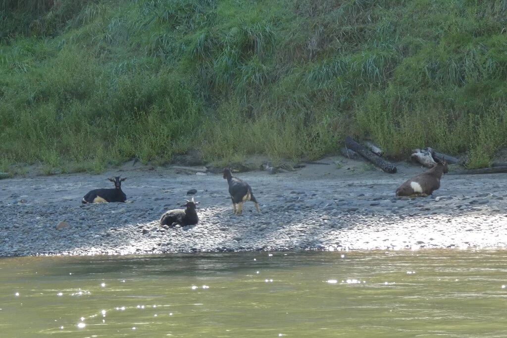
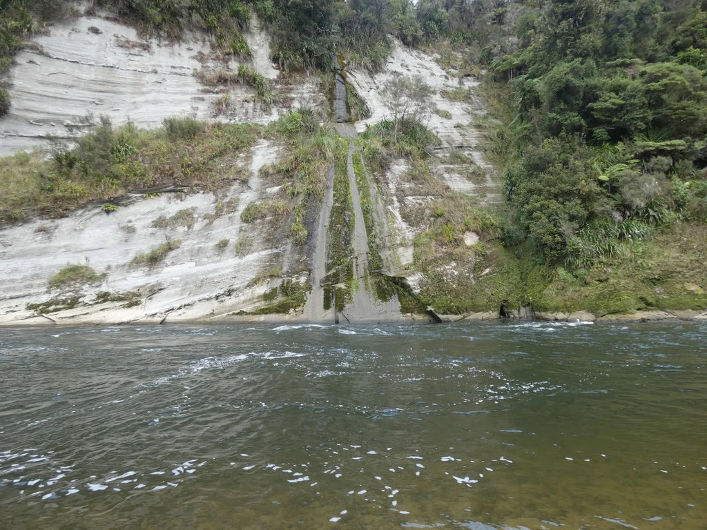
There were noticeably fewer swallows than on the first two days. Swallows, grey ducks, mallards, and goats. (“MP, there are four goats.”) There were more cliffs.
At dusk, we managed to see bats over the trees at the hut, and the warden found a bat listener, which made clicking noises when the bats were echolocating. Too hard to photograph, though.
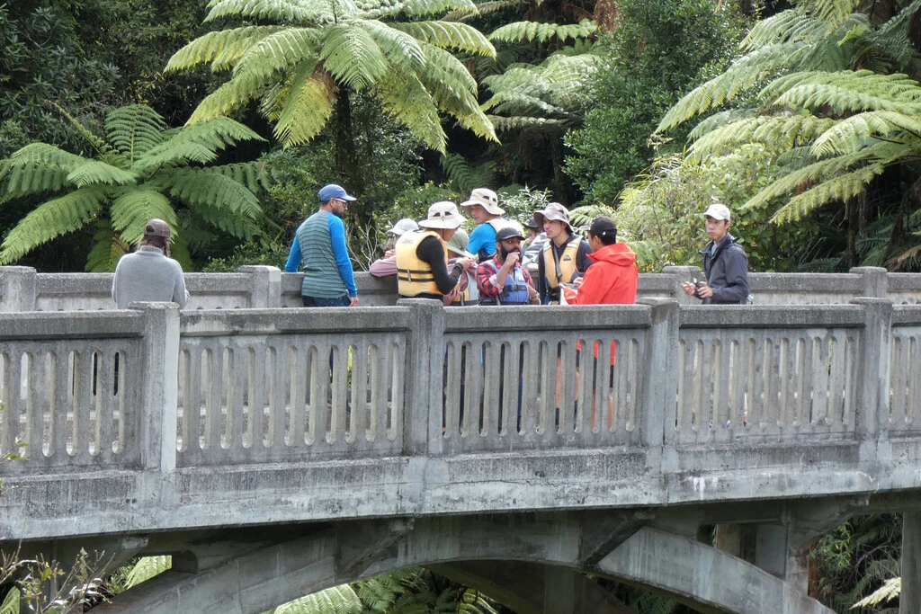
Day 4: Bridge to Nowhere; John Coull to Tīeke Marae/Kāinga, 33km
An average day, with 32km on the river from Whakahoro to Tīeke Marae/Kāinga. There were again good conditions, with few rapids (Class 1 I’d say, barely more than EV). Sunny and little wind, so we averaged 7km/h. Unfortunately MP’s sunglasses went swimming when I tried to get them out of the backpack. There were too many things in the top pocket and they just went flying as I was taking other things out. I think one’s best chance to recover an item is immediately. Otherwise it sinks and there is too much current to circle around.
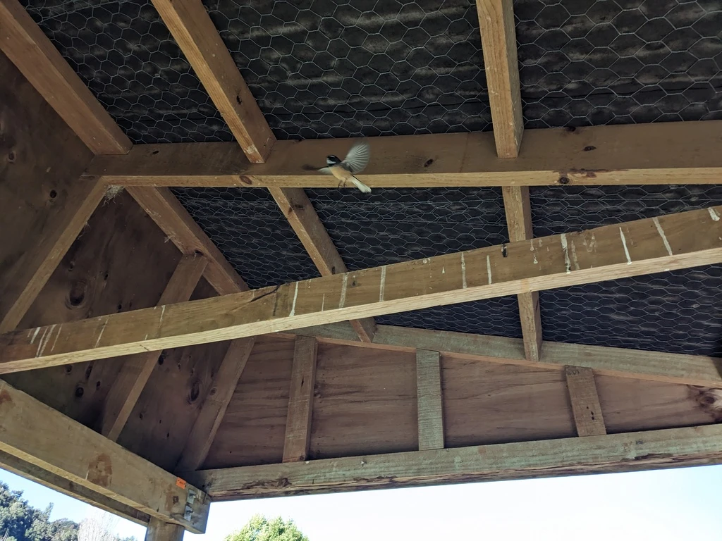
Again noticeably fewer swallows than on the previous days, though sometimes there were bunches. At the hut there were possums and mice, as well as blackbirds and sparrows.
This day is the chance to visit the Bridge to Nowhere, which is otherwise accessible by mountain bike or by jetboat. We were perplexed by the jetboat operations. There were two boats that looked like they were trying to dock. One did. The other boat hung around for a while and then just went back.
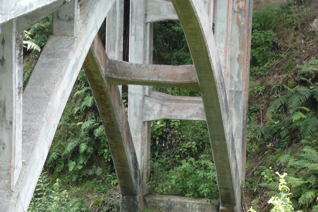
Anyway, the bridge (surprisingly far from the water, 1.5km) is a significant infrastructure project, with tons of concrete over the river. There are some signs of the post-WWI settlement, but not many. Yes, it is possible to engineer this bridge, but was it really a good idea? Well, I guess the engineers were just carrying out their instructions.
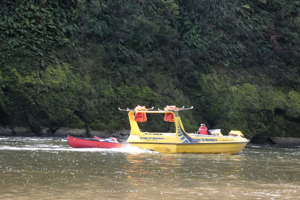
The jetboat then ferried canoes over the river for reasons unclear to us. I heard something about a nosebleed in another group.
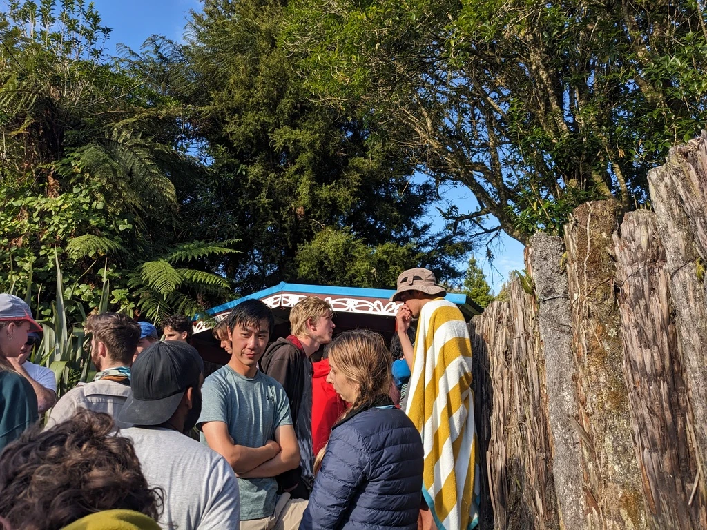
After just a bit more canoeing, we arrived at Tīeke Marae/Kāinga, where there was (eventually) a powhiri to welcome us, by river guide Stacey, the warden, and his son. The Asian group must have been staying across the river at the Bridge to Nowhere Lodge; there was Rob’s group, the group of 5, the Aucklanders, the Germans, and Stacey’s Canadian clients (maybe one other group). The bunkhouse at Tieke Marae was far from full, and it was just us and the Germans in a room with capacity 10.
Day 5: Featuring the 50/50 Rapids; Tīeke to Pipiriki, 22km
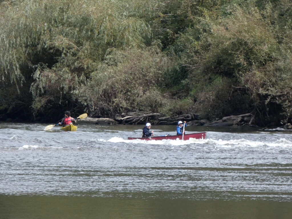
After day 1, the next hardest day is supposed to be day 5, from Tīeke to Pipiriki. There are 5 significant rapids, of which the last one (just before the dock at Pipiriki) is allegedly the hardest, with 50/50 representing the chance of swimming. This is also a short day, with just 22km of paddling; we were told that leaving by 8am should get us to the 1pm pickup on time.
We ate our ramen and managed to leave by 8. The Germans and Rob’s group left before us. I was continually impressed by how quick Rob’s group was at logistics. Usually it takes a while for 14 people to leave. Throughout the trip, the Germans paddled faster than us, but took more breaks, and we always ended up at the destination before them.
Given how people had talked up this day, I stowed everything in barrels. I did run Gaia GPS tracking from my phone inside a barrel. That works. No pictures between Tīeke and Pipiriki.
The weather was cloudy but, thankfully, windless. Our average speed was again about 7km/h. There were again fewer swallows than on the first few days, though still some, and some grey ducks. Maybe one shag.
Some of the rapids were noticeably harder than what we’d seen over the past few days. But nothing was actually hard on this day, including the 50/50. Indeed, almost everyone got through the 50/50 without swamping. It was definitely easier than in this video, even if everyone had said that it was hard around now due to the low water levels.
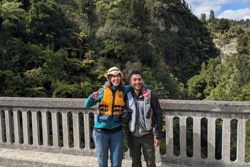
Despite starting after Rob’s group, we caught up to them (as we always did) and were the third canoe through the rapids. Afterwards, we had lots of time to unpack our stuff from the barrels (since we were getting off the van in Raetihi), enjoy the cupcakes and orange juice, and even take a voluntary dip in the Whanganui. While we were repacking, others were loading the canoes onto the trailer, which is quite a production.
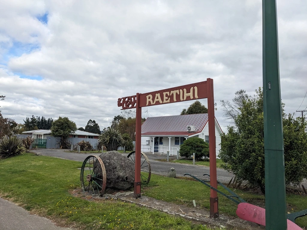
Emerald Hours said that Pipiriki had decent tourist infrastructure. Can’t say, though Google shows only two adventure tour operator bases and no hotels or restaurants in 2024. We just stayed at the dock and then hopped in the minibus, which was about 30 minutes to Raetihi.
Back to Wellington
Raetihi is not bustling. There is a Four Square, one café that is open all day (plus one morning-only café), and a tourist information centre. Ohakune would have been better (and has eclairs), but it’s 10km down the road. I think the InterCity bus comes from Ohakune.
The Taumarunui Canoe Hire van seems to have stopped at Ohakune before getting up; I saw a bag of carrots under the front seat, which is a thing you can get in Ohakune in addition to eclairs.
In any case, we made our way to Raetihi’s Coach Café. We had 2 hours there before our pickup at 4. MP had bacon, egg & Hollaidaise and I had creamy mushrooms and egg. Exceeded expectations. There were several groups at the cafe, including a large group of older women when we first came in, and then a family later. Before leaving the cafe, we checked out the tourist information; there was also a museum but we didn’t make it there before it closed at 3. And, we took some toasties (steak and onions, again excellent) to go.
The InterCity bus was a few minutes late but got us to Bulls, where we changed for the service to Wellington. The bus to Bulls stops in Whanganui briefly. So we got to see the river once again. It is possible to paddle from Pipiriki to Whanganui, though apparently there are fewer places to stay. It’s probably not as fun; I’d guess that it would be mostly flat and wide.
The bus to Wellington does not take Transmission Gully but stops in Porirua and other places. I left my hat on the bus, oops.
Wellington was windy and cold. We waited 8 minutes for the #4 bus and made it back to Kelburn.