TR Navigation
Other parts of this trip report:
- Part 1: Australia versus New Zealand
- Part 2: Before the walk [Melbourne photos, Hobart, Launceston]
- Part 3: Overland Track day 1, Cradle Mountain [photos]
- Part 4: Overland Track day 2, Windermere [photos]
- Part 5: Overland Track day 3, Pelion [photos]
- Part 6: Overland Track day 4, Kia Ora [photos]
- Part 7: Overland Track day 5, Bert Nichols [photos]
- Part 8: Overland Track day 6, Narcissus [photos]
- All Overland Track photos
Itinerary for Day 4 from New Pelion Hut to Kia Ora Hut—mountain day
“Today is mountain day” says the guidebook.
The mountains are optional but there are 3 that one can do, including Tasmania’s highpoint, which is Mount Ossa (and not Cradle Mountain). “If fine weather and time allows, you may choose to attempt to summit Tasmania’s highest mountain (Mount Ossa, 1617m).” Without the mountains, it is another short 3-4 hour day, with 8.6km and 300m elevation gain/loss. We had about 10 hours of daylight and fine weather, so we did indeed climb Mount Ossa, and then I managed to talk MP into climbing Mount Pelion East as well.
The other mountain that one can climb is Mount Oakleigh, but that is best done either on a rest day, or, as many people who hiked with us did, at the end of (short) day 3. Book time for day 3 is 5-7 hours and for Oakleigh is 4-6 hours, so definitely doable in a day, if one is at the fast end of the range, though it would still be wise to start before sunrise.
I had actually seen Mount Pelion West on the map; it would also be on day 3, but the trail looked overgrown and there was a fair amount of elevation gain.
For Ossa and Pelion East, the book says add 4-5 hours for Ossa (“medium-hard”) and 2 for Pelion East (also “medium-hard”). We did the whole thing in 10 hours, which is at the midrange of the book’s time estimates.
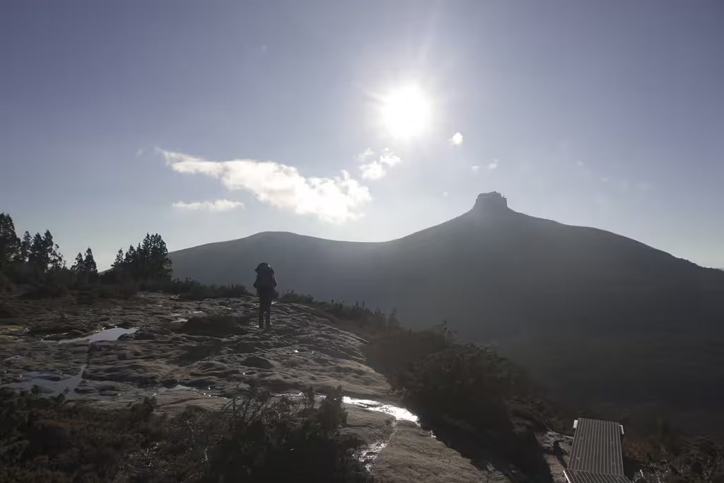
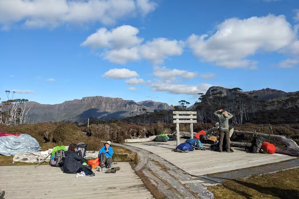
To the Gap
Pelion Gap is where one turns off the main Overland Track for Ossa and Pelion East. We left New Pelion Hut just before 7AM and walked mildly uphill through the forest for two hours. Not much to say about this part of the walk. We saw some mushrooms, pholiota malicola?
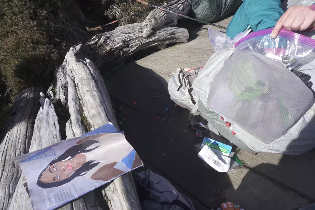
We’ve previously talked about currawongs’ propensity to steal food. They can open zippers. At Pelion Gap, there’s a warning about them on a sign on the ground.
Not wanting to reproduce the Cradle Mountain lack of food problem, this time I brought my pack up, though we put everything heavy into MP’s pack.
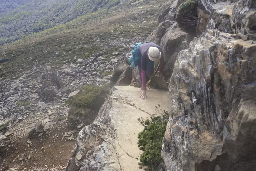
Mount Ossa
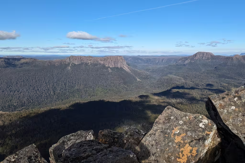
A state highpoint! The ranger at New Pelion Hut had advised that even if one wasn’t going to summit Ossa, it was well worth it to walk 15 minutes, under Mount Doris, for the view. The track was boardwalk and paving stones for quite a while.
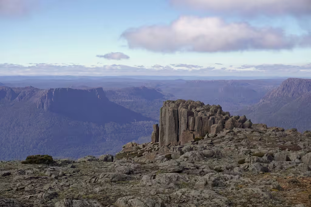
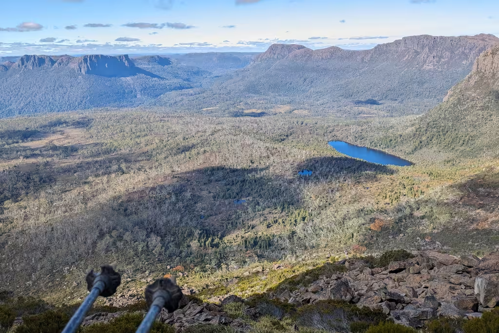
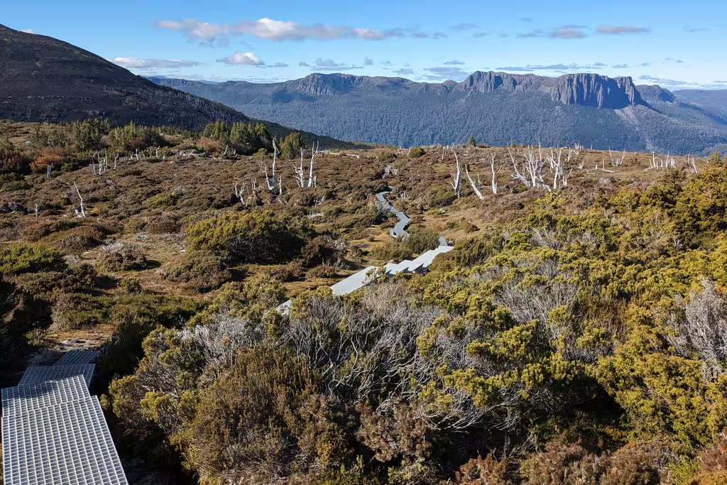
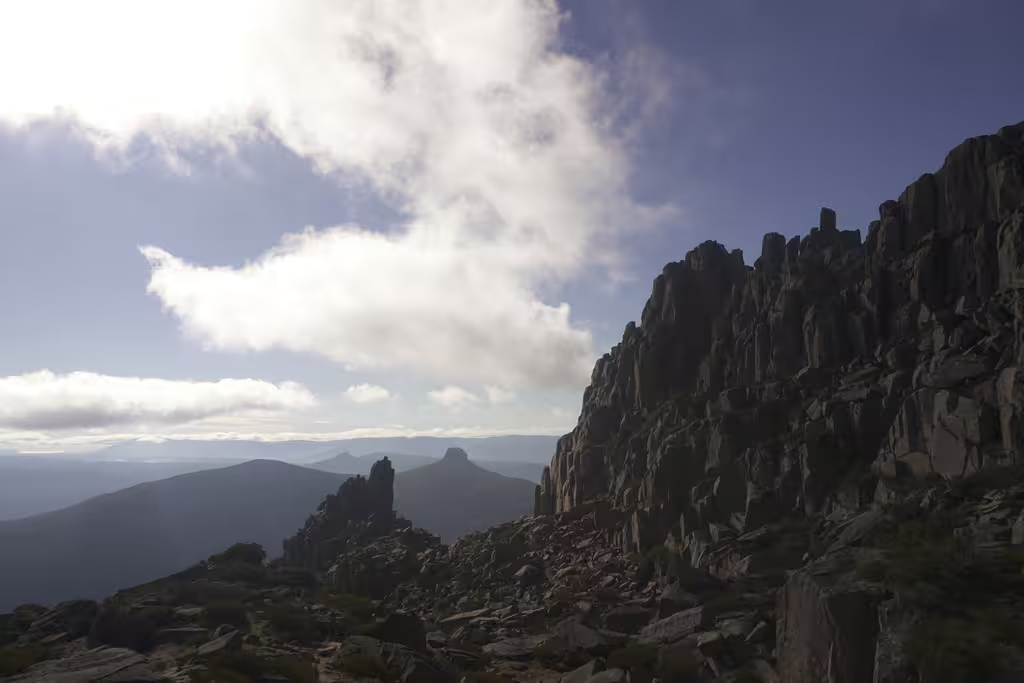
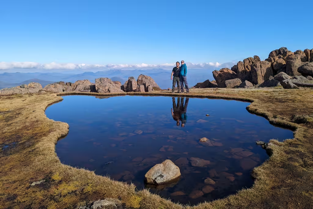
Eventually there are stairs and then a boulder field, where we stowed our poles for the scrambling-ish part. Things are fractal, and so there is Pelion Gap between the mountains, and then the summit plateau of Ossa was also guarded by two subpeaks; we take the scree between the subpeaks. After ascending the scree, there is a striking tarn, which makes a great photo spot. But it’s not quite the summit. It’s about 50m vertical below the summit.
(Wow, the GPS info on my pictures, even the ones from my phone, is quite bad, especially the elevation info, listing some 1154m elevations near the 1600m summit.)
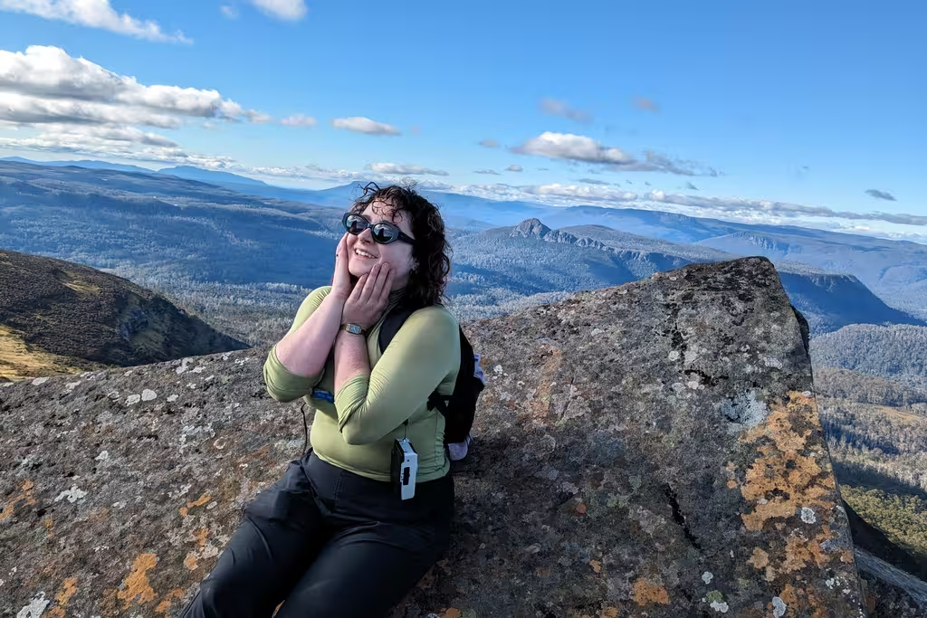
The actual summit is another 10 minutes’ walk away, through a bit of a boulder field. I didn’t actually stand on the summit, which is a bit exposed, but I did touch it. Couldn’t ask for a better day for views. On the way down there was some chiaroscuro on the hills and on Lake Macfarlane.
Back at the Gap
I don’t have many positive things to say about pack covers (or liners). They are just more to carry. Maybe they keep your stuff from getting wet, but I use dry bags for that.
One advantage of a pack cover, though, is that currawongs can’t operate the zippers if a pack is protected by a pack cover.
We didn’t have pack covers, and did have food “protected” by zippers, so a currawong ate many of our snacks. No more M&Ms for us. I think that putting the snacks in the bag itself, rather than the Aarn pack’s front pouches, might have worked. Currawongs aren’t keas and I don’t think they tear through nylon.
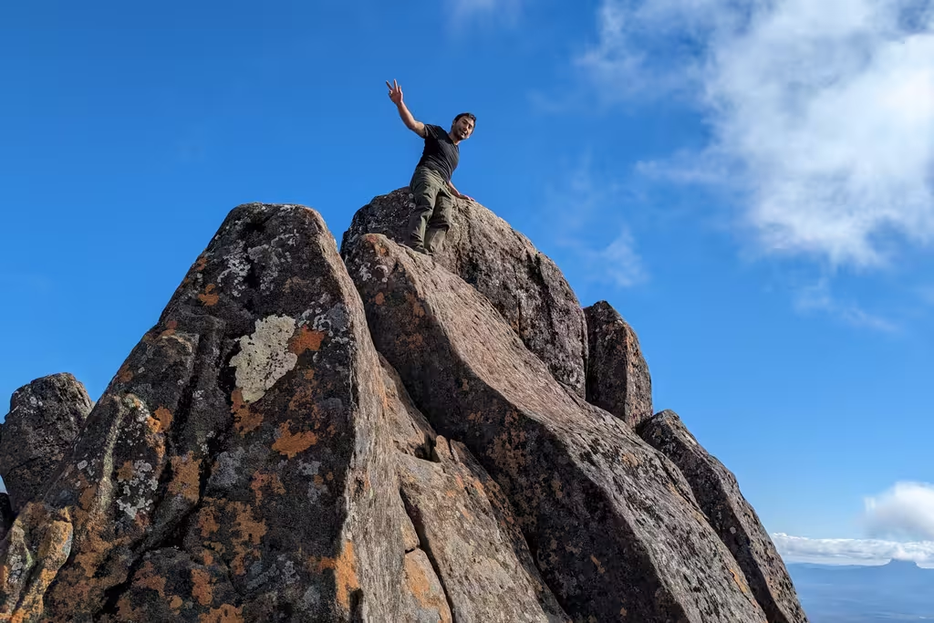
Mount Pelion East
Anyway, we were back at the gap at 1:40PM, and had another hour of walking to Kia Ora Hut. I figured that we would thus be able to get up Pelion East and back to the hut by 5pm, which was sunset. MP agreed and off we went.
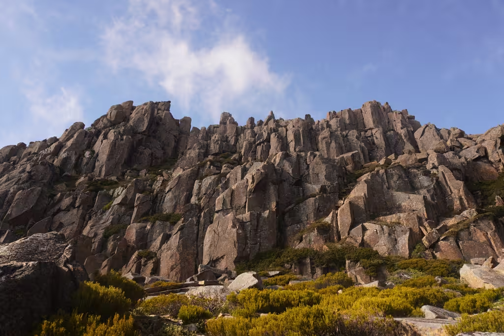
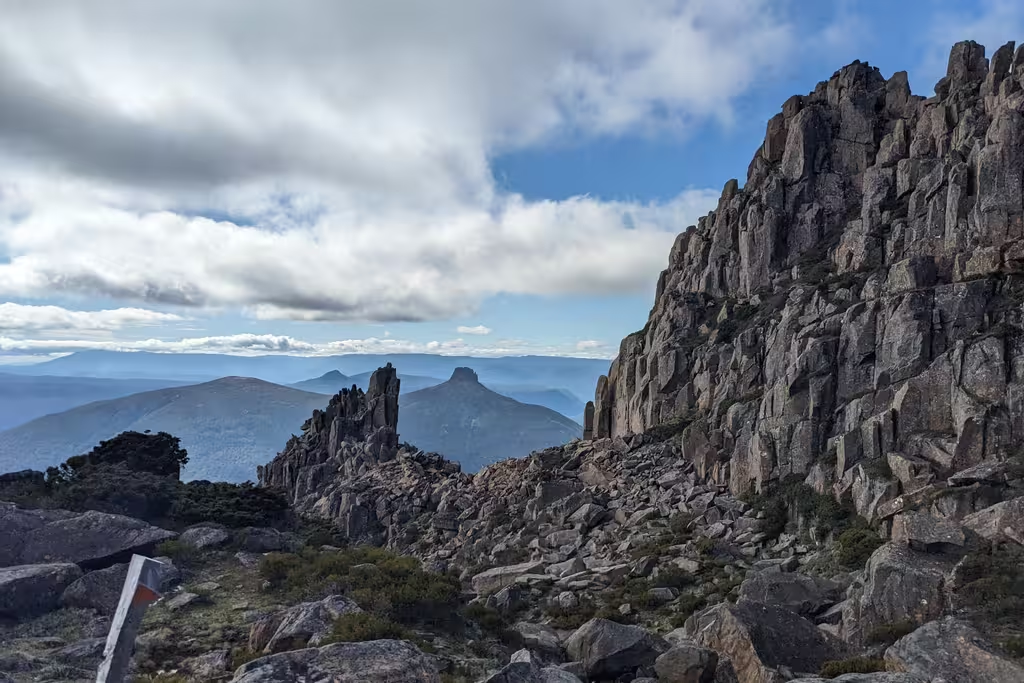
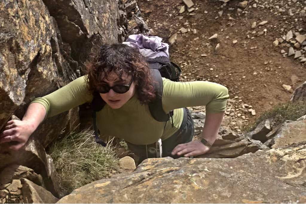
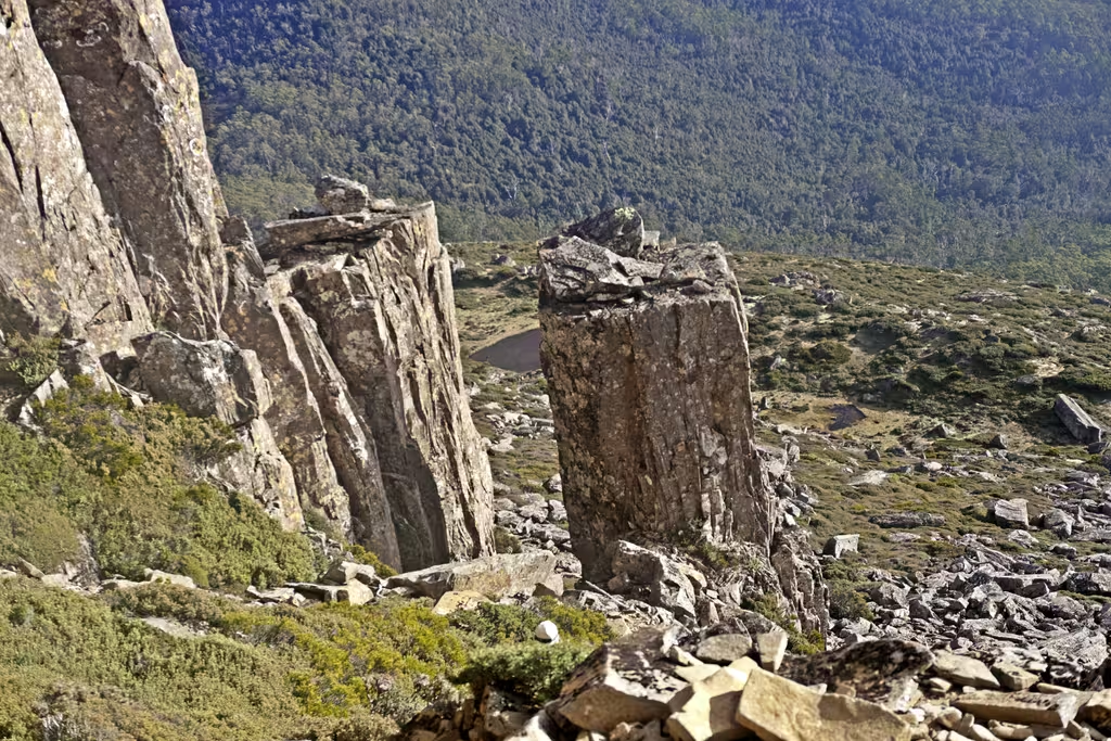
Mount Pelion East has a lot of (ex-glaciated) slopes before hitting the rocky nunatak for the last 50m or so. So there’s this big chunk of rock that you just keep on walking towards. After the boardwalk, it’s reasonably well cairned, though you do have to look for the cairns going left.
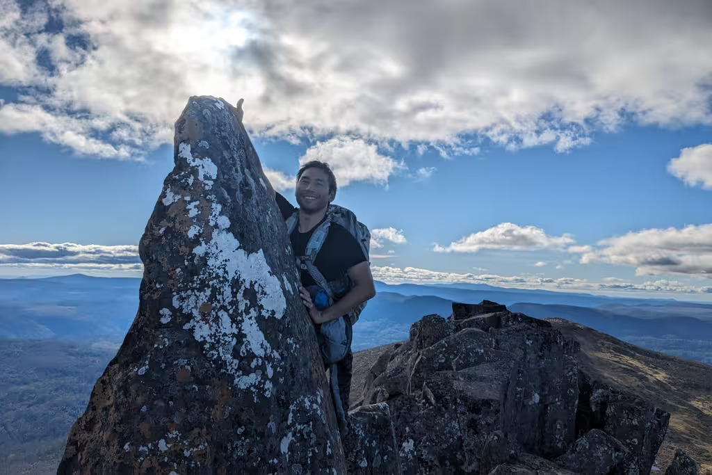
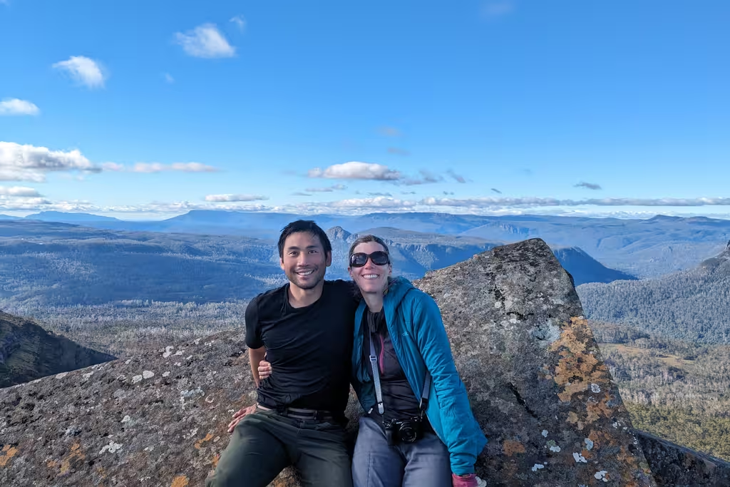
Emma was talking to Hanna for a bit and then caught up with us for the last scrambly bit of the climb up Pelion East. Which was useful for getting pictures of us! There are some pillars which you don’t climb, just two or three rock climbing moves. There is more climbing possible on the solid rock, but the falls could be super bad.
I once again tagged the summit (which was actually pointy) and we all enjoyed the views. Then it was back down the rocks and the grassy slopes.
I did notice some birds in the trees just before getting back to the gap, but we didn’t really have time to spy on the birds too much. Definitely a currawong, but maybe also some thornbills. Also I only had the 16-50mm kit lens on the summits, which is generally not suitable for bird photography.
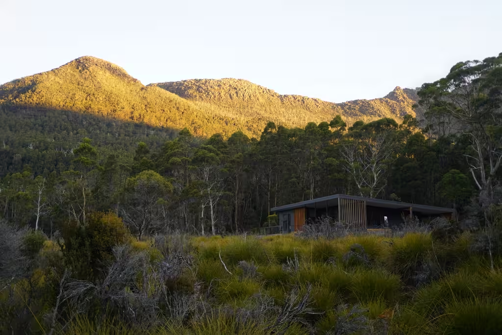
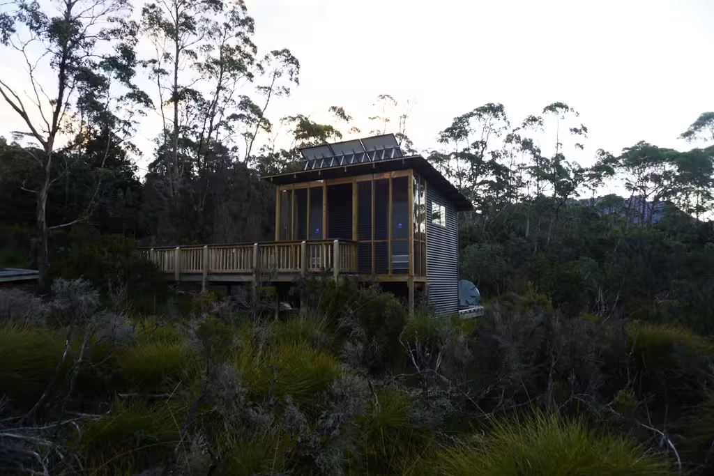
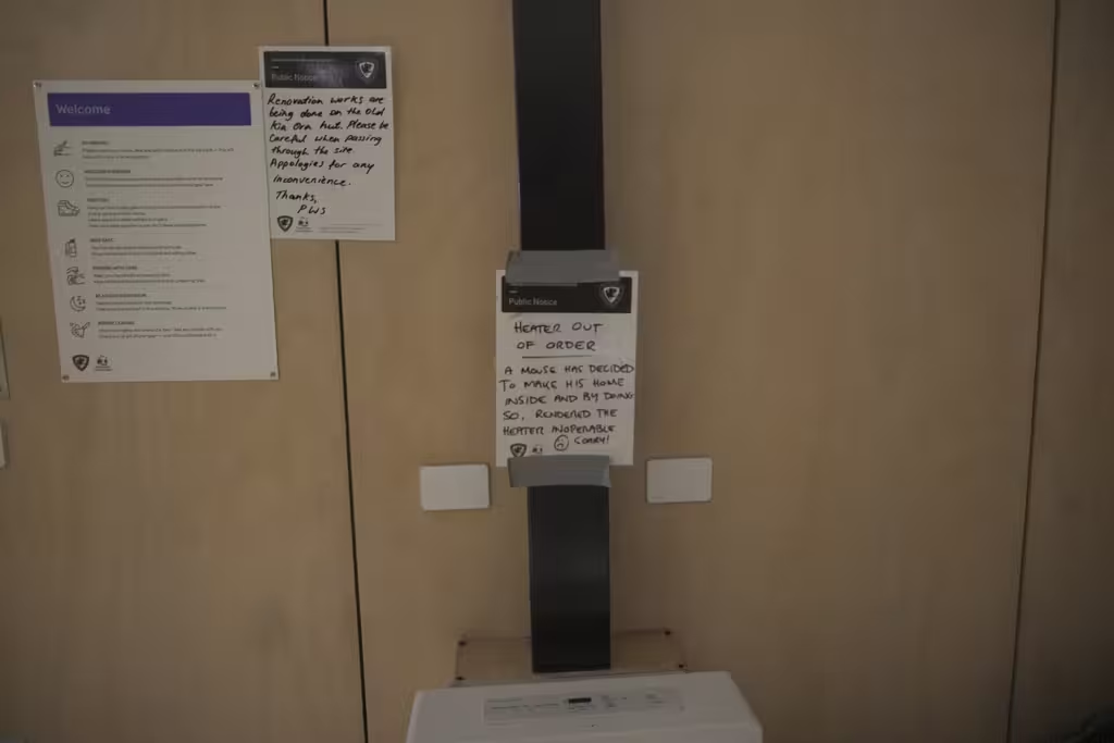
Kia Ora Hut
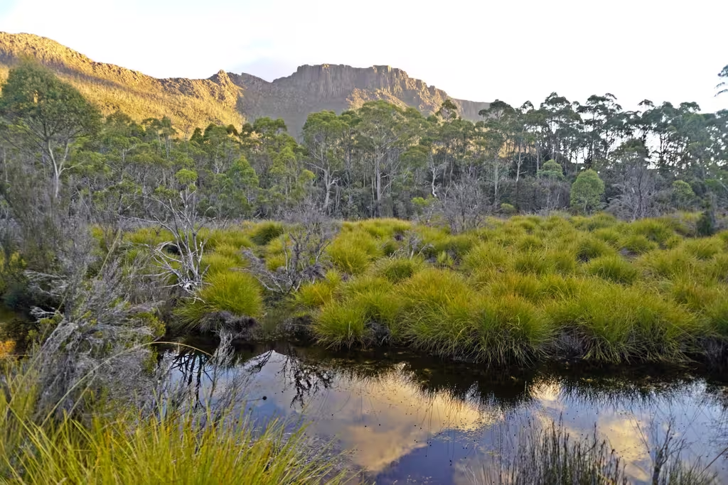
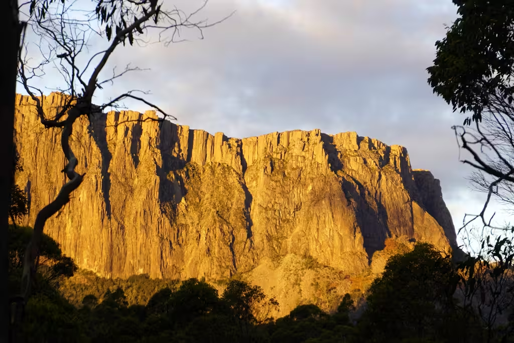
We repacked and ate some of our diminished snack supply, leaving at 3:50PM (so just over 2 hours for Pelion East). One could definitely see Pelion East’s distinctive shape on the way to Kia Ora Hut. It was once again easy boardwalk, and I got some good golden hour photos of Cathedral Mountain as we approached the hut around 5PM. Heard yellow wattlebirds (whose call sounds like barfing) but didn’t see any.
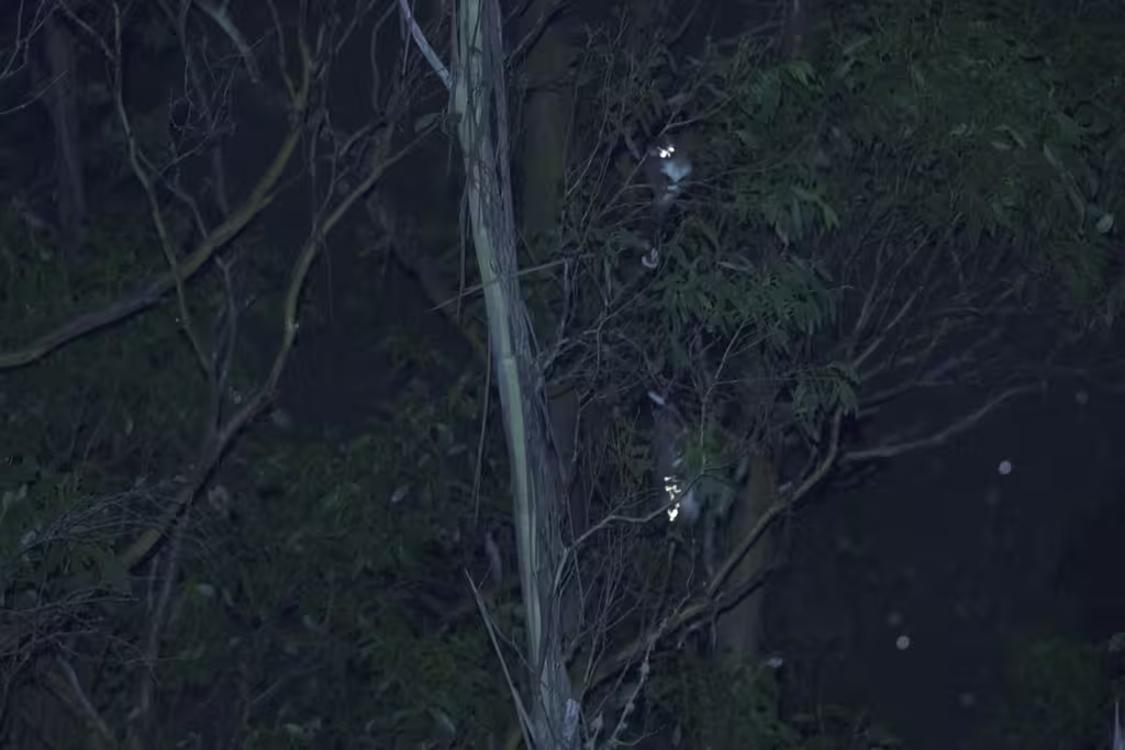
There is a thing in Australia called “spotlighting”, where one attempts to see night animals. I did manage to see some possums outside Kia Ora Hut, though didn’t really get good photos of them. There were 3 of them, including ring-tailed possums.
About that hut name
“Kia ora” is a te reo Māori greeting often used in Aotearoa New Zealand. Tasmania is not part of Aotearoa, so what gives? It is hard to find this information on the Internet, but it is written on the interpretative plaques in the huts. Unfortunately I didn’t take pictures of these plaques. The Internet says that Kia Ora Hut was initially built by Paddy Hartnett, who had spent time in New Zealand when he was younger. I also have some recollection that it was actually a friend of Harnett who was credited with the name. Anyway, there is definitely some sort of connection to Aotearoa, but I don’t have authoritative information about the connection. The plaques are far from me.
Ironically, Kia Ora Hut (newly rebuilt for 2022) was by far the warmest hut on the trip. Too warm. Which is totally not the case for average NZ housing. There are new housing standards put in place by the previous Labour government, which now require adequate insulation, though I just read in the news that the National minister in charge of Building and Construction wants to roll them back (they want to roll everything back, even things that are supported by 99% of comments during the public comment period).